Wadi Foukin: A Palestinian Paradise Devoured by Settlements
The name of Wadi Foukin (Foukin valley) village, near Bethlehem, is thought to have origins in the Canaanite Aramaic language; where the word “Fouk”, which was made plural in Arabic to become “Foukin”, was most probably pronounced as “Souk”; therefore, so to speak, the meaning of the name would be “Wadi Al Shaouk/Thorns Valley.”
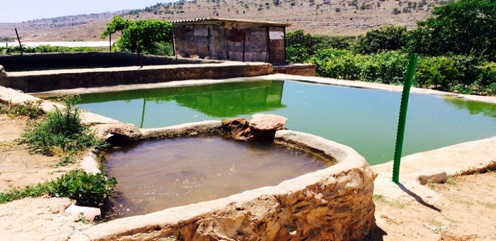
Rainwater harvesting ponds form part of an old irrigation system in the village, which is still used until today.
Bethlehem- Palestine Economy Portal | Asma Marzouq- Counter to the meaning of its name, Wadi Foukin is a peaceful, green village, with hillsides full of apricot, berries, and grape trees, and fruits that taste as sweet as the water of the village’s seven water springs. Wadi Foukin is well known for its rainwater harvesting ponds spreading between the houses and the fields, which form a part of an old irrigation system that adds an exquisite touch to the place. However, the charm of the area has made it a covetable target for settlements ever since the Israeli Occupation started.
Wadi Foukin village aligns the “green line” which was drawn in 1949 to separate the lands that were occupied in 1948 from the rest of the country. Although it was not occupied then, and was considered to be outside the borders of the green line, it has suffered ever since from continuous Israeli aggressions. In 1954, most of the village’s people were forced to leave to Dheisheh camp, or some of the surrounding villages.
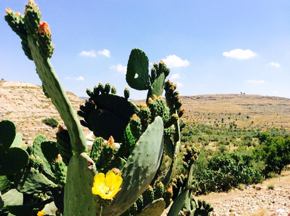
The occupation controls three fourths of the village’s area.
People of Foukin Earned their Return early
The people of the village did not allow the occupation to disroot them from their land, so they continued to cultivate and harvest it in secret, despite living away from it, until they were able to fully return there in 1972 as a result of negotiations with the Israeli Occupation.
However, the occupation did not leave the people of the village to rejoice in their land. They started stealing the land gradually until there was only one fourth of it (3 thousand Dunams[1]) left for the people from its original area, which was 12 thousand dunams. In addition, they restricted the area allowed for building on only 200 Dunams classified as a (B) area, while the rest of the village was classified as a (C) area.
Betar Illit, one of the West Bank’s biggest settlements, housing over 50 thousand settlers.
Settlements Swamp
Four settlements surround the village of Wadi Foukin; to the north is Betar Illit settlement, which is one of the biggest settlements in the West Bank, housing over 50 thousand settlers; while the three other settlements (Givot, Tzur Hadassah, and Hadar Beitar) complete the suffocation of the village.
However, settlements put aside, what makes matters worse is the apartheid wall that encircles the village and isolates it from its surroundings, and which, if completed; would seize an additional 1700 Dunams of the village’s area.
President of the village council Ahmad Sukkar says, “The new settlement project targets confiscating hundreds of dunams of Wadi Foukin. The most dangerous thing regarding these schemes is in confiscating and closing the only main street that reaches the village from the northern side; keeping in mind that that israeli army delivers several notices of confiscation to the people who stay in their land.”
Sukkar says that the people of the village have applied several claims to the Israeli Supreme Court to stop land confiscation decisions, but they did not do any good.
Bombings and Wastewater!
Sukkar adds that the violations of the Israeli occupation are not limited to land confiscation, but also include the behaviour of the settlers. Sewage pipes are opened towards the agricultural lands of the village situated below the settlements, thus causing damage to the crops and the soil in that area. This has also damaged the reputation of Wadi Foukin’s crops in the market, which have always been known for their high quality.
He explains: the explosions that accompany construction excavations have caused a huge loss to the underground water by either drying a number of the villages’ water springs, or causing the reduction in the productivity of some others; therefore negatively affecting agriculture. In addition, the explosions also caused huge damage to the buildings close to the settlements as a result of vibrations, like what happened to village’s school.
A map from Google Earth demonstrating the distribution of settlements surrounding Wadi Foukin village.

